Trail Map:Rankin Preserve Trail Map. (Map courtesy of Joshua’s Trust Intern, Rachel Beach.) Directions: Trailhead is on Route 89, 0.5 miles north of intersection of Route 44 and Route 89. Traveling north, watch for the Trust sign and a section of split rail fence on the left.
About the Property
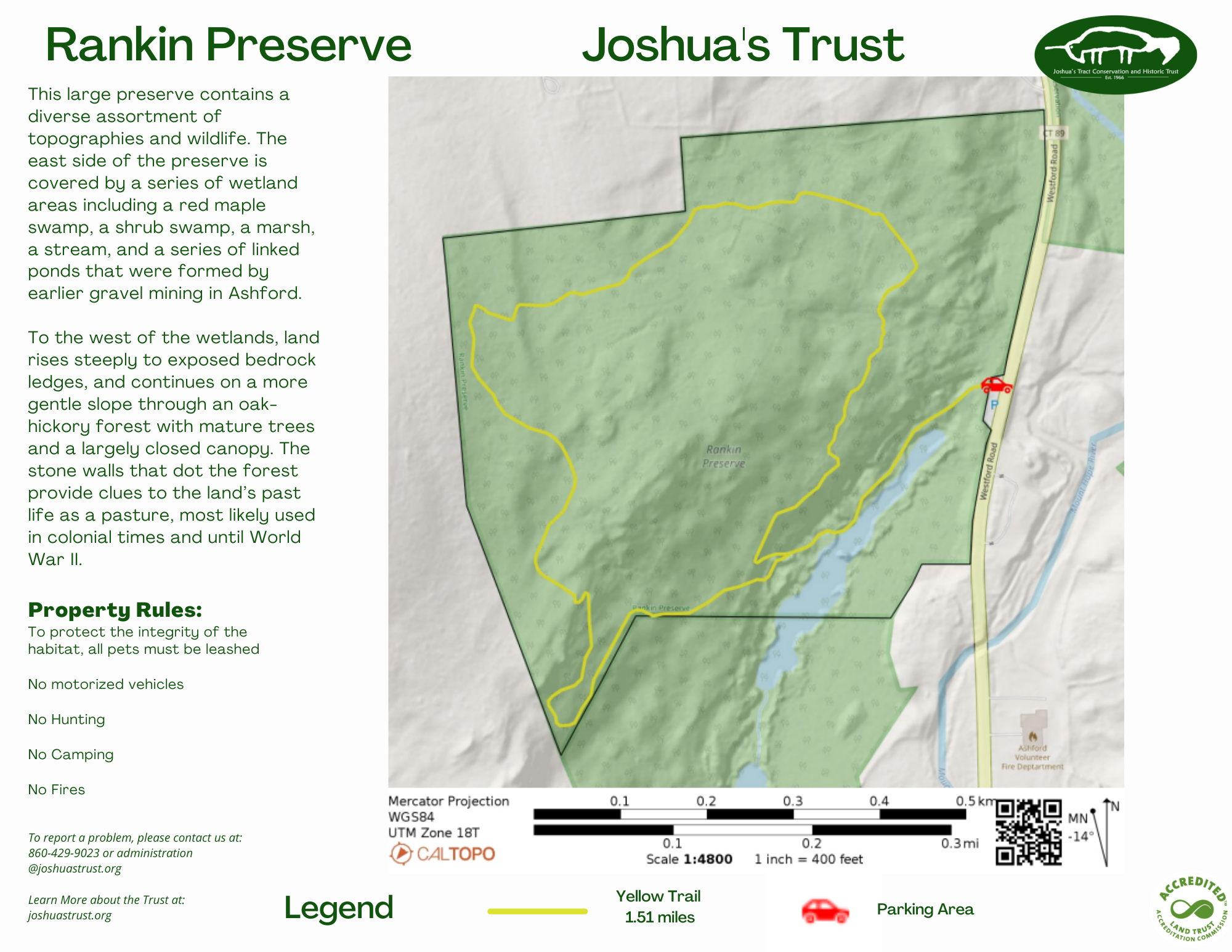
This large preserve contains a diverse assortment of topographies and wildlife. The east side of the preserve is covered by a series of wetland areas including a red maple swamp, a shrub swamp, a marsh, a stream, and a series of linked ponds that were formed by earlier gravel mining in Ashford.
To the west of the wetlands, land rises steeply to exposed bedrock ledges, and continues on a more gentle slope through an oak-hickory forest with mature trees and a largely closed canopy. The stone walls that dot the forest provide clues to the land’s past life as a pasture, most likely used in colonial times and until World War II. Intermittent streams run from the forest in the west to the wetlands in the east.
The Rankin Preserve abuts a large town-owned parcel. Both parcels play an important role in protecting a part of the Mt. Hope River watershed, as well as the many wetland habitats associated with it.

